Detroit bus system map
You can find on this page the Detroit buses map to print and to download in PDF. The Detroit bus system map and the Detroit trolley map present the network, stations and lines of the buses and trolley of Detroit in Michigan - USA.
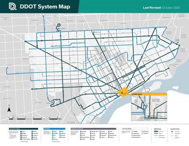
Detroit bus map
The Detroit bus map shows all the stations and lines of the Detroit bus system. This bus map of Detroit will allow you to easily plan your routes in the buses of Detroit in Michigan - USA. The Detroit bus system map is downloadable in PDF, printable and free.
The DDOT was created in 1922 as the Department of Street Railways. The department became the DDOT in 1974 under the Detroit City Charter (Detroit City Code Reference 7-1401) as its mentioned in Detroit bus map. Streetcar services was discontinued in 1956, with rail transit not resuming service until the Detroit People Mover was added in 1987. The People Mover is currently operated by a separate city agency called the Detroit Transportation Corporation. The Suburban Mobility Authority for Regional Transportation is the suburban bus system providing services outside the city, although SMART buses come in and out of the city on their routes. Greyhound Lines provides nation-wide service to the city of Detroit and the metropolitan area. Greyhound station is on Howard Street near Michigan Avenue. Detroit Amtrack Station is located at 11 West Baltimore Avenue and links to DDOT and SMART buses.